Gorge Climatology: Wildflower Quest on February 20th
The climate of the Columbia River Gorge is unique because it
telescopes several climate zones into the space of 70 miles. It extends from the arid, warm east-side near
The Dalles, OR to the center of the rain forest near Cascades Locks, OR to the
temperate west-side at Portland. The annual rainfall numbers are
startling. Portland gets 37 inches of
rain a year, while The Dalles gets 14 inches and Cascade Locks gets a whopping
76 inches!
With less rain and more sun, the east end of the Gorge tends to get warmer daytime temperatures. That’s why our pursuit of spring wildflowers begins along a region near Lyle, WA and Mosier, OR. Catherine Creek, just west of Lyle, seems to come to life first. With an open south-facing meadow, it catches the sun and gets the warmth of the river waters.
 |
| View of Catherine Creek from Memaloose Overlook |
 |
| Map from: "Wildflowers of the Columbia Gorge", Russ Jolley |

The first stop was Memaloose Overlook (part of Memaloose State Park). It is directly across the river from Catherine Creek. Like Catherine Creek it is a meadow with good sun exposure, but it is not tilted quite as favorably toward the sun and lags in flower development by a couple of weeks. Since there were only a few pitiful wind-whipped Grass Widows, we paused long enough to photograph the castle-like rocks on both sides of the Columbia.
We moved on to Tom McCall Preserve. This perpetually windy spot gets plenty of sun but is harsh for plants because of its exposure to the river winds. Before we opened the car doors we spotted this squirrel with its unique white eye ring sitting on the ground as though praying. It is a Douglas’ Squirrel. Usually he stays in the nearby Doug Fir forests.

We spotted a few hardy Grass Widows.
Then we were treated to an aerial display by a beautiful Red-tailed Hawk.
The first quarter mile of the trail goes through a small oak savannah. We climbed up the steep slope to the sign-in, and then out to a basaltic outcrop where the pink Columbia Gorge Parsley was blooming at the base of this giant fortress-like stone formation.
But the highlight was the discovery of a couple of Yellow Bells (J-28). These dainty lilies are harbingers of their cousins the Chocolate Lilies and Glacier Lilies. We will return here often in coming weeks looking for them.
Finally, we moved on to another rocky area, the trailhead of
the Labyrinth Trail. On our way we spotted Mt Hood. Its sides were being lapped at by wispy
fast-moving storm clouds. The mountain was our weather forecast.
The Labyrinth Trail starts out following the Old Highway 14.
It was blasted out of a basalt cliff and is now abandoned and left for
hikers to enjoy. Water tumbles over the top and seeps through cracks in the
rock. During the summer Ravens and Cliff Swallows make their home here. But for
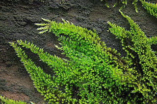
now it is the quiet determination of the lichens and moss and the stonecrop (J-197ff) which are beginning to come to life.
The weather here is doing its usual dance – two steps toward
the warmth and one step back to cold. Forty-eight hours after we left, this
area received a dusting of snow. But we’ll be back in two weeks to check on
progress.
Copyright 2013 Tom Nelson
All Rights Reserved
Please ask before you use my photos


